My intentions were good when setting up this blog three years ago...and that's the last time I posted something. During the summer of '14 I did a good job keeping things up to date and since then I've done a terrible job. Finally, three years later, I've made the time to post an update. While I was gone for about a month, drove nearly 9000 miles, made countless good memories, not to mention a few stupid decisions, this post will focus mainly on the time spent in and aroundYosemite with Collmar, Finan and Lupp.
Every journey needs a theme, but it can't be forced, and Lupp was happy to unwittingly provide us with that theme about halfway through our time spent together: the Year of the Ram.
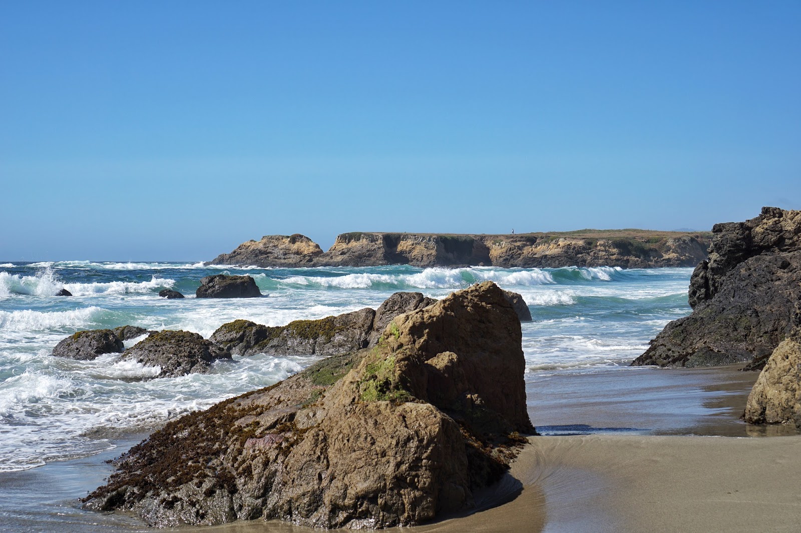
I picked Lupp up from the Sacramento airport on the morning of the 28th of June and we quickly made a plan to head to the coast. We knew we had to be back in Sacramento at least by the next morning to rendezvous with the rest of the team but didn't want to do nothing in the meantime, so to the coast it was. It looked like Fort Bragg, CA was the closest point to where we were so that's where we went. We hit up a local coffee shop, downed a few shots of espresso, and then headed for the bluffs, followed by thee beach, followed by a local Italian pub were we ate some pizza and more important had a couple good brews. Some of the finer points of Fort Bragg as are follows:
 |
| The view from the bluffs were pretty awesome. The surf was really kicking up and the temperature was perfect: high 60s with an ocean breeze. |
 |
| Something in Fort Bragg was coming soon: unfortunately Lupp and I didn't have enough time to hang around to find out what that something might be. |
Collmar was flying standby and ended up letting us know that he would be getting into Sacramento late that night so Lupp and I humped it back from the coast and picked him up. From there Collmar was able to score a hotel with a corporate discount and we were all soon passed out and anticipating the final member of the crew, Finan, to join us the next morning...which indeed he did! We made a few pit stops: iHop, Costco, Safeway Zen Automotive (the greatest, friendliest mechanic in Sacramento who replaced a u-joint for me at the drop of a hat..I wish I had more time to explain...), a local pub...and finally off to towards Yosemite.
Because of my u-joint adventure, we arrived somewhat late to the park. We made a snap decision to camp in the national forest right outside of the main entrance and get up early to beat the crowds into Yosemite Valley the next morning. The first half-hour(ish) of making our way into the park was fairly unspectacular, but we knew that would change before long. Sure enough, we were soon greeted with magnificent views of the valley.
We stopped for a few photos of the awe-inspiring landscape and then continued on towards a picnic area close to Yosemite Village to cook up some breakfast..where the views continued not to suck.
From there we walked into the village and headed toward the ranger station where Finan waited in line for an hour for our permits. During said wait in line, Finan heard questions, such as the following, being posed to the rangers:
"Can you show me how to use this map?"
Yeah. Scary.
Once the permits were in hand we decided to hike up to a viewpoint to view Yosemite Falls before driving up to the trailhead for our campsite which sat some 3000+ feet above the (hot) valley floor. As we made our way up the steep and sandy trail to the lookout to the falls, the "big cup" of our trip, Half Dome, seemed to scream at us from across the valley. What an impressive and imposing monolith.
 |
| Half Dome as seen from the trail up to Yosemite Falls. We would be climbing the backside in a couple days. |
By the time we got back down to the car, drove up to the trailhead for Westfall Meadow, packed our packs, and headed in to find a campsite, it was mid-afternoon. It didn't take us all that long to get into the meadow, although it took us about the exact same time to scout and finally find a place to pitch the tents. There was a fairly deep, somewhat warm and slow moving stream running through the meadow and it was perfect for just lounging in for a little while.
 |
| Crossing the stream upon entering the meadow. |
 |
| A nice place to soak. |
After napping for a bit and then cooking up and consuming our dinner, it was time for bed. Collmar had purchased a sleeping bag rated to 40 degrees F for this trip and he was fortunate enough to test that rating! It cooled off quite nicely at 7,000 feet and in the morning we were greeted with frost.
 |
| Cool, frosty morning in Westfall Meadow. |
We decided to head back to the car and drive to Glacier Point where we would make our breakfast: instant oatmeal! The views once again were dominated by Half Dome and we were getting more and more excited for our upcoming attempt at the summit.
 |
| Half Dome from Glacier Point |
After our breakfast we made our way back towards the trailhead for Westfall meadow with a stop-off and little hike to Taft Point. The views here offered us a great perspective of El Capitan, second only in fame to Half Dome in Yosemite. In fact, just a couple weeks prior, Alex Honnold (you may recognize him from his famed climb of Half Dome for which there was a 60 Minutes special) had completed the first ever free solo of El Cap. That means he climbed from bottom to top without any ropes, safety harness, parachute, etc. 3000 feet and 3 1/2 hours of sustained climbing harder than what most of us could do for even 100 feet. Yea. That guy's mind is on a totally different level.
 |
| El Cap - recently climbed, with no protection, by Honnold. Wow. |
Upon leaving Taft Point and returning to our campsite in Westfall meadow we had a decision to make: to truly "camp" another night in the meadow or not? We wanted to get a very early start on Half Dome the next day as we were hoping to beat the crowds and also catch sunrise from the top. We ultimately decided to go back to the campsite, nap as much as possible in the afternoon and then pack up camp and head back into the valley where we would hang out until it was time to start our ascent up to Half Dome. We made it back down to the village that evening, found parking space in the Half Dome Village parking lot and burned time by walking around, eating icecream and drinking coffee. Some of us attempted one last short nap session at around 10:30, but by that time our excitement was too high for any meaningful sleep to occur, so we packed our daypacks and started making our way to the trailhead.
 |
| Lupp ready to roll |
We started from the trailhead and almost mid-night and made our way through the dark with only our headlamps for light. There was a time or two when we lost the trail for a short time but never for very long and we made pretty good time. Because it was dark we didn't capture much evidence of our trip up, but what still sticks with me is the sound of rushing water. The Sierras received a massive amount of snow this past winter and the level and ferocity of the rivers and creeks coming out of the high country attest to that.
Its about 9 miles one way and we made it to the base of the last 400 by around 4:40 AM. I had read about the route online and looked at pictures so I knew the last 400 feet were quite steep. That's why this route is given the name of the "Cables" route, because every May a team of rangers sets up parallel cables from the base to the top with supporting stanchions every 10 feet through which the cables run. Needless to say, I was not prepared for how steep the final ascent really was. I am not dabbling in hyperbole when I say that a fall while going up the cables is almost certain death. The rock is steep and incredibly slick. There have been relatively few deaths while ascending or descending the cables route in season (usually June through September) but that fact doesn't lessen the realization of what could happen: believe me!
 |
| Waiting for sunrise atop Half Dome |
 |
| After some contemplation we decided going down facing the direction of travel was the best bet. |
 |
| Eric coming down...he's actually already more than half way down when this picture was taken. |
We were officially the first ones to the top of the Half Dome (there were a few unofficial, illegal campers up there) and the rest of the 8 or 10 people who arrived before we descended had harnesses and tethers with which to clip to the cables as they went up. I'm not sure if that is standard practice and on hand hand it makes sense from a safety/piece of mind standpoint, but it would also require a lot of unclipping and reclipping past each stanchion which would be quite annoying.
After getting to the bottom of the sketchy portion of the climb we all toasted with a beverage of the extra hoppy variety and continued on our merry way. Within the hour we were stopped not once but twice by rangers who wanted to see our permit. As we got further and further down and closer to the valley floor there were more and more people and the last mile or so was absolute bedlam. At one point we had to duck because one young lady was standing in the middle of bridge with a selfie stick taking a 360 degree panorama with no regard for the other 100 humans on that bridge. Madness.
When we finally got back to the village we had a one track mind that revolved around pizza and beer. Both were marvelous. We then followed signs for a shower house, which we thought was a free shower house, alas it was not. It cost us each $5 in the end, but it was worth it. That night we stayed in what is known as the "Backpacker's Camp" which is billed as a place for backpacker's to stay the night before or the night after returning from a journey in Yosemite. We awoke early the next morning, packed up camp, grabbed a few large coffees, and made our way out of the valley before throngs of people were awake.
Our next destination was called Carson River Hot Springs which sits on the border of California and Nevada. We knew roughly where to go but stopped at a ranger station on our way and looked up some directions for the jeep trail/4wd portion of the route. In the description we found in the Jeeping guide book it was rated as "Moderate" and described the trail as "Easy in most parts with a few steep, rocky sections. Stock vehicles with skid-plates and moderate clearance should be able to make it." That description became a running joke among us because that trail tested me and the 4Runner to the max. Of course, maybe the sign we saw we got to the start of the off-road portion should have been a good indicator as to what we were getting ourselves into:
 |
| Road Closed? How bad can it be? |
 |
| Oh, THAT'S why the road's closed. |
After getting hung up in a washout literally 90 seconds into the drive up the road, you would think that we might call it quits and say, "Hey, at least we tried." But, no. We pressed on...and on...and on...for four more hours of "moderate" off-roading.
 |
| There was a lot of holding on tight on this ride. |
 |
| This was an all too common view of the rock/boulder situation on the road. There was a lot of spotting to be had. Spotter of the year awards go to Collmar, Finan and Lupp. They're my heroes. |
When we finally made it to the river I was exhausted, mentally, and just happy that the 4Runner made it there without a catastrophe. It was an awesome place to camp with a picnic table, flat spots only a few dozen feet from the Carson River and a short 5 minute walk to hot spring that was somewhere around 105 degrees.
 |
| A view of our campsite next to the east fork of the Carson River. We were only slightly worn out...nothing a shot of Fireball wouldn't fix! |
 |
| Oh, how quickly the mood was lifted! |
 |
| The hot spring water had been corralled by someone with rocks and mortar so form a small pool in which you could sit. The contrasting temperature between the river (55 degrees) and the hot spring (105 degrees) was awesome. |
 |
| A little instant coffee and a morning foot soak before leaving. |
It was the morning of July 4th and fortunately we had scouted out an alternate route for getting back out to the main road. While there were still a few rough patches, it was nothing compared to the Barney Riley jeep trail we had come in on. We didn't see another person the whole time until we were almost out. A man and his wife, originally from Wisconsin and Packers fans to boot, were coming down a rocky section in an ATV. When we told them the way we had gone in the day before the only reply from the man was, "Oh, sh**!" Yea, that abut summed it up.
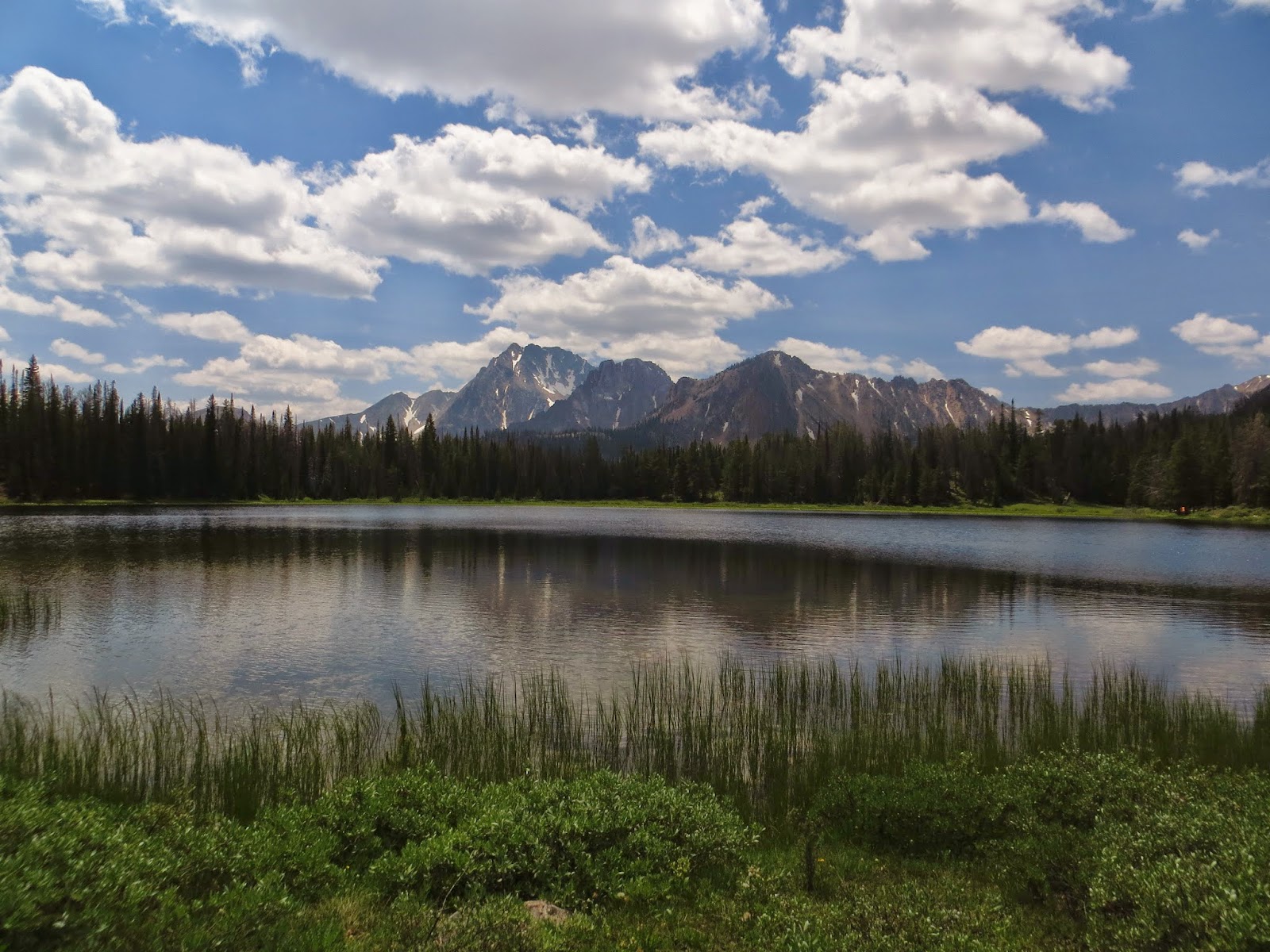
Soon enough we were back at the pull-off where we had left Finan's car. We loaded up and headed towards Lake Tahoe: our final destination before the gang split up. The plan was to hike into Susie Lake in the Desolation Wilderness, set up camp and then get to the top of Mount Tallac to watch the Tahoe fireworks. Well, after a longer than anticipated hike to the lake along with still significant snow cover on many of the high slopes, we conferred and decided against the hike up Mt. Tallac. We instead enjoyed some dinner on camp stoves and a few beers to celebrate the fourth, all while sitting a great rock right next to Susie Lake. It really was a great way to spend the last night of an amazing trip.
 |
| A great spot to relax right next to Lake Susie. |
 |
| Looking over the lake after sunset |
We got up very early the next morning, packed up camp and headed out. We wanted to get down early and hit up Denny's before we had to go our separate ways. Needless to say, the creek crossings felt a lot colder that morning than they had the afternoon before!
 |
| Lupp's body language aptly describes our feelings about creek crossings at this point |
Once we got back to Lake Tahoe and filled our bellies with copious amounts of Denny's nourishment, it was time to split up: Lupp and I towards Salt Lake City and then on to Colorado where he would fly out of Denver and Finan and Collmar up to Sacramento where Collmar would (eventually) fly back to Savannah and where Finan would continue driving on to Eugene.
It was an absolutely fantastic trip filled with a lot of hiking, plentiful chicken and rice/noodles, and many healthy doses of sarcasm. Writing about it three weeks later already makes me want to start looking towards the next opportunity. We truly took many Paths Less Traveled during our week together.
Cheers!