Tuesday, July 29, 2014

The Last Leg of the Journey

Well, sorry for such a delay on the latest entry to the blog! Between dropping Andy off in Portland and arriving back to Ohio it seems like I have hardly had time to sit down for any uninterrupted "blogging" time. Alas, now I have a little bit of time and am ready to compose this final (for now) piece of the puzzle. Also, a quick thanks to the beautiful, charming, smart, (insert adjective here), Chelsea Kilway for keeping my nose to the grindstone when it came to getting these posts up in a semi-regular manner.

In the last installment of this blog we were just getting ready to leave Joe and Chelsea's in Pleasanton, CA and head north. After the World Cup finale we loaded everything into the car and began making the trek. That night we stopped just outside of Shasta, CA. We found an old forest service road, drove up a couple of miles next to a creek and found a nice flat place to park and sleep. The next morning we took a little bit of time to attempt to explore the surrounding area and I say "attempt" because it was rather unsuccessful. After 15 minutes of bushwhacking up some incredibly steep, and loose, ground without getting any closer to the rock formations we kept seeing through the trees, we decided it would take too much time to get there and turned around.

Before long we were headed north once again and soon out of California and into Oregon. To keep with the theme of hitting all of the running meccas of America during our journey we stopped in Eugene to check out Tracktown USA. As luck would have it they were setting up for the IAAF World Junior Championships and a gate was open so we were able to get into Hayward Field and onto the track. We then drove up to Pre's rock (don't know who Pre is? Look him up.) and got some pictures before getting a run in on Pre's trail...You still haven't looked up Pre? GO DO IT! We ran a few miles on the trail before jumping back in the car and continuing our journey north towards Portland.

Once in Portland we decided to go check out Nike's world headquarters in Beaverton, OR. We parked in a spot specifically designated "Visitor Parking" and began wandering the campus. We spent some time on the 5 lane track which is surrounded by woods and which has woods on the infield as well. After a couple hours walking around the extensive campus we decided to head back (east) into Portland proper with the eventual goal of meeting up with one of Andy's friends who actually works at Nike. Just before pulling out of the parking lot we were stopped by a security guard who told us that we had "raised awareness" by taking pictures, etc. He nicely told us to leave and we obliged.

After meeting up with Andy's friend at a local brewery and talking training theories and about the American distance scene in general we headed towards the Portland airport. We dropped Andy off around 11:00 PM. His intentions were to sleep in the airport for a while before his flight. Gus and I were sad to see him go as the last ten days had been tons of fun. We headed east across I-84 for an hour or so before finding another old forest service road. We slept in the car for five or six hours and then continued east. After an 11 hour drive we found ourselves in the mountains of central Idaho near the Sawtooth National Forest. After a little bit of preparation for the next morning's hike in and playing a little bit of catch with our mits (something neither Gus nor I had done in a LONG time) we went to bed in the car (the back seats fold down to yield a "full" sized bed" with the setting sun in anticipation of our next backpacking adventure.

We saw no need to rise too early so we slept until 6:30 AM or so and were headed down the trail by appox. 8:00. We started around 7000 ft elevation at the trailhead and hiked to just shy of 9000 ft. It was a fairly gentle hike as it took a little over seven miles to make the ascent. We made it to Frog Lake around 11:00 and after a little exploring around the lake for a campsite settled on a nice spot. This was the first campsite at which a fire was allowed so that evening we made a nice fire and some good campfire conversation.

The next morning we headed out to explore Boulder Chain Lakes: a string of lakes which technically started at the lake at which we camped. We were much lighter on our feet than the previous day as we had our small daypacks on. After a small detour (read: we were talking and didn't pay attention to which way the trail was actually supposed to go) we gained the first lake of the day and marveled at the scenery. As we continued to hike we hit another lake in less than a quarter mile, and then another and then another. Each lake was just slightly higher in elevation than the last and connected by a creek which was mellow at times and raging at other times.


After the fifth lake or so there was a decent break between it and the next lake and by the time we reached the next lake there was a good amount of snow. While we were skirting one of the lakes we had to cross a snowfield in which I promptly fell up to my waist in snow. Gus initially thought I was trying to kneel on one knee. We skirted a few more lakes before finally leaving the trail and scrambling to the last lake called Lonesome Lake, which sits at 10,400 ft. The scramble up to Lonesome Lake was steep, but it was on solid rock and very fun. We pumped some water into our bottles and took a few pictures before heading down. If the scramble up to Lonesome Lake was fun and steep, the descent was a little less fun, a lot steeper, and much sketchier. The combination of mini-cliffs, loose scree and snow fields made me regret leading Gus down this way, but he handled it like a pro. I failed to get any good pictures of the route down which speaks to the concentration I paid to every foot and hand placement. Rule number one when leading people through the backcountry: always act like the route you chose is easily doable and relatively tame. The truth is, I was definitely a little nervous!


On our way back to camp we ran into some rain showers, but nothing too heavy. In total, we hiked 12 miles that day and saw 10-12 lakes. The heaviest rain occurred while we were trying to cook our Mac'n Cheese, but it never lasted too long and our fire lasted through it all. After some more campfire conversation we cleaned up and headed to the tent. I awoke fairly early the next morning and started a nice little fire to take the chill off. It was 44°F and a beautiful morning at Frog Lake. We were in no particular rush to get going but knew we had a good five hour drive to our next destination so we didn't waste too much time and were on the trail before long. It took just over 2 1/2 hours to make our way back to the car. Compared to the 11 hours in the car a few days ago, five hours felt like nothing and we soon found ourselves arriving at my Uncle Roice's place in Freedom, WY, about 50 miles south of Jackson.

We spent two nights at Uncle Roice's place and he was a great host. It was wonderful to have a bed, a shower, and great familial company. It had been six or seven years since I had last seen him so it was wonderful to catch up. It was also nice to be able to change my oil, as it was definitely time! We arrived there on Friday night and on Saturday decided to head up to Teton National Park for a little hiking and exploring. The place was a zoo, being a Saturday in July, but we hiked a seven mile route which took us by two lakes, Bradley Lake and Taggart Lake. We were told by multiple parties we met that there was a mama bear and a year old bear up near a trail junction, but after "searching the bear" (as a French girl we met called it) we never did see them unfortunately. It was a bit hazy due to some fires in the far west (California and Washington) but the view of Grand Teton and the surrounding peaks were marvelous.


The only snafu with the car came as we pulled onto Uncle's Roice's road on our way back from Teton National Park...a flat tire! Thank goodness it happened less than half a mile away from his place and thank goodness his place is like a tool factory! I had everything I needed at my disposal and switched the flat out for the full size spare I had. The plan was to get the tire patched somewhere along the journey the next day.


I woke pretty early the next morning and was afforded some time to sit in Uncle Roice's hot tub. It was a cool 46°F so the 105°F water felt great. After a little breakfast we re-packed the car, said good-bye to Uncle Roice and headed south along the western border of Wyoming, even crossing into eastern Idaho for a while, before heading east. We stopped in Laramie, WY to get the tire patched, and after an hour delay and $10, the previously flat tire was back on and in good repair! In total, it was a long, 13 hour, day in which 650 miles were covered. We finally arrived back in Divide, CO at the Gragg's house around 9:00 that evening.

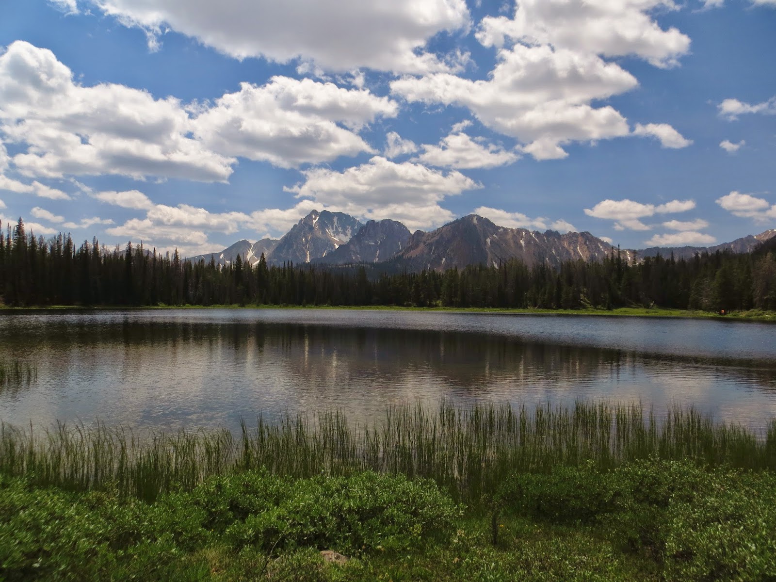
The next few days we spent in Colorado, attempting to relax a little bit yet still use the last few days of our trip to our advantage. We headed up to Boulder one day, as it was the last great running mecca that we hadn't run at yet. Not only did we run in Boulder, but we ran Magnolia Road: a road made famous by Coach Whetmore at the University of Colorado for grueling 16-20 mile runs at 8100-8800 feet. Needless to say, we only ran 4, but that was enough to get our hearts pumping and our lungs gasping for air. In those last three days we were also able to tour the Olympic Training Center, run and hang out with Olympian steeplechase finalist Bridget Franek, and do a little bit of rock climbing.


We stayed at some good friends, the Cockrille's, house on our last night on the east side of Colorado Springs as that put us an hour closer to home for our long journey the next day. We left the Cockrille's place at 3:43 AM the next morning. We skated through Coloardo and Kansas quite easily before hitting a little bit of traffic in St. Louis, MO, but we decided to just pull off and get some dinner and wait the traffic out. We were soon back on the road and by 1:30 AM EST (11:30 AM MST) we were back in Mt. Orab, OH. In total, the last leg of the trip occupied nearly 20 hours of our time and totaled a little over 1200 miles.

In closing, the trip was a huge success. At the last minute we deiced to cut out our last backpacking destination in the Wind River range of Wyoming. It is somewhere I was very much looking forward to exploring, but I could feel myself getting tired and I want to do that place justice. I decided that it was best left for another trip when I was fresh and eager to enjoy it to the fullest. The adventuring partners I had along the whole journey, Calleigh, McCoy, Andy and Gus, were wonderful companions. Spending time in God's wonderful, mountainous, creation is something I think I will always enjoy. As the journey was coming to a close I found myself thinking about the upcoming school year and cross country season more and more. I think the trip legitimately revitalized and refreshed me for the upcoming school year. I hope you enjoyed keeping up with the adventures vicariously through this blog. A few statistics of the trip can be found below.

From Mt. Orab, OH back to Mt. Orab, OH:

Miles Driven: 8574.2 (I now have 240,000 miles on my 4runner and still going strong!)

Gallons of Gas purchased: 421

Average Gas Mileage: 20.4 (not bad for my 2000 4runner with an old 6 banger)

Distance Hiked: approx. 85 miles

Elevation Gain: approx. 25,000 ft


I would be remiss not to mention that since Andy and Gus arrived in Denver they set out to find all 50 license plates of the United States in our travels. Well, during our last full day in Colorado, Gus spotted the last plate of Delaware. He may forever hold it over my head that I wouldn't turn the car around to get a picture, but fortunately we did get a picture of what some may consider to be the hardest to find, and that is Hawaii. I will admit that I had almost nothing to do with the finding of these plates, other than doing a large chunk of the driving and allowing the two of them to devote copious amounts of energy in this endeavor. Congrats, boys! You truly achieved greatness.


Sunday, July 13, 2014

Three Amigos in the Grand Canyon

Well, what a whirlwind of a week it has been. Grand Canyon, Flagstaff, Vegas, Death Valley, Mammoth Lakes...but I'm getting a bit ahead of myself. TWO people have asked me why I haven't posted in over a week. That's two more people than I thought might be following this blog regularly! Anyways, I digress...

I spent Friday night with great friends, the Cockrilles, in Colorado Springs in anticipation of an early morning on the way to DIA to pick up Andy and Gus (my 4th trip to Denver International Airport in 10 days!). It was 4th of July so Ms. Eva and I hiked up to the ridge above their house once it got dark and watched some fireworks, both amateur and professional, from around the Springs.

This was post-canyon backpack, but look at those shoes!
Andy was originally scheduled to land at 9:00 AM Mountain Time and Gus was scheduled to land at 9:55, but both of their flights saw changes and Gus ended up landing at 9:05 and Andy at 10:00. It was great to see both of them. It was nearly six years ago that the three of us (and Jimmy Gnecko) found out that not only would we be teammates but also roommates for our first year of college at the University of Akron. Grant Hall, baby! Just as evidence of our like-mindedness and similar tastes, Andy pointed out that all three of us were wearing the same pair of shoes at the airport. When I say "same pair" I mean same brand, model, generation number, AND color, and NO it was not planned. Seriously, it wasn't planned.

We piled into the 4runner and headed west and south, back towards Divide where we would stay for the first night before heading further west. We took the back way and drove along the S. Platte River for much of the way, eventually stopping in the metropolis of Deckers for lunch. Yes, you can get lunch in Deckers! The rest of the day included stocking up on food for the next few days at the grocery store, helping Steve move a few heavier items around at the house, driving around the old stomping grounds, and organizing everything for the kick-off of the trip the next morning. Right before dinner, we did a nice 3 mile run. Gus and Andy had yet to experience the effects of high altitude while running so it was a necessity to get a few miles in at 9300 ft elevation. Speaking of dinner, Kelli made some excellent Keenwah tacos and it gave us a chance to stock up on some hearty food in preparation for a few days in the Grand Canyon.

Pre-dinner at our first campsite: Kaibab Ntl. Forest
We got on the road the next morning (Sunday) just a little after 7:00 AM and began heading south-west towards the Grand Canyon. The initial plan was to first go to Flagstaff, AZ so we could get in a nice little run in one of the running meccas of the United States, but it was raining VERY heavily as we passed the turnoff for the east entrance of the Grand Canyon and coupled with the fact that the day was getting late, we decided to head straight for the Canyon and hit Flagstaff on the way out. We ended up running a couple miles on the rim of the Canyon as we searched out our trailhead at which we would start the next morning. We ended up camping just south of Grand Canyon Ntl. Park in the Kaibab Ntl. Forest. We made some dinner and then swiftly headed to bed.

Early morning light on canyon towers
We awoke around 4:15 and began packing up, organizing our backpacks, and heading towards the TH. We had to park about a half mile from the TH itself so the first 8-10 minutes of hiking were along the road. It was still dark enough that we had to use our headlamps when we arrived at the trail but the sky was beginning to get somewhat lighter and it wouldn't be long until we didn't need them anymore. The reports I found online about our route down the canyon, called the New Hance Trail, mentioned that it was the shortest trail from rim to floor and I believe it. I use the word "trail" loosely here as often it seemed like the trail was non-existent and we were simply following the path of least resistance. Over the first couple miles there were many spots where the trail dropped 2-4 feet and careful foot placement was necessary. It was thus within the first hour of the trek down the canyon that I realized my new "big hauler" pack was packed a little too much and I already started dreading the hike out. They always say if you have the room you will use it, and I guess they are right! But...such is life.

The trail continued to wind down the canyon and every time we took a second to look back at where we came, it was hard to believe that we had come from there. Looking up, it seemed like there was no possible path out of the seemingly vertical walls of the canyon. Even more amazing was the history behind the New Hance Trail. A man by the name of John Hance initially went to the Grand Canyon in the early 1880s for mining purposes but soon realized that tourism was the real hot bed. He then began taking people down the canyon on this particular trail on mules. Now, I know the Grand Canyon is famous for having a couple trails in which mule trips are feasible, but THIS particular trail did not seem feasible for a mule in the least.

A typical look at the canyon layers and the steeps from which we came. 
We finally made it down out of the steep part of the canyon and into the final stretch which follows a dry (usually) drainage to the Colorado River. We were treated with some spectacular view of the canyon as we made it near said drainage. It took longer than expected to reach the river from thee drainage than we expected, but on the way we saw some great rock formations, including a rock which had been naturally formed into the shape of the Greek letter "pi." Remember kids, math is everywhere!


Math is EVERYWHERE!
View from our campsite
We finally began to hear the river and before long it came into view: what a glorious sight it was! We found a nice spot to pitch the tents and were soon basking in the cool water of the Colorado River. After a short nap in a shaded area which ended up being infested with ants, we did a little exploring around our campsite and continued making frequent trips to the river to cool off: the 100+ degree temps of the canyon floor required as much. We headed to bed fairly in early in anticipation of some more extensive exploring of the canyon the next morning.

The night was filled with a lot of heat and a little bit of rain but we started the next morning in good spirits and ready to check out what the floor of the Grand Canyon had in store. We paralleled the river for a while until reaching a very large rock-slide which came down from the south wall of the canyon. As we scrambled up the large boulders and began gaining elevation we were treated with the best views of the canyon we had seen yet. We eventually spotted a nice little beach which housed some shade and we figured eventually we would make our way there. However, I was intrigued by the potential scramble up the rest of the rock-slide and continued up to the top, all the while watching rafts float by.

Getting ready to climb up the steep rock fall
Our new-found beach upriver

Good perspective on how steep the rock-fall was and how far up we made it
Getting accustomed to the cold water before the swim to the other beach 
Once we reached the beach we saw from the distance we chilled in the river for a while and eventually Andy and I decided to swim to another little beach across the "channel." Well, what an experience that turned out to be. The swim there was very uneventful considering it was WITH the current. We realized, however, that the swim back might be a little more challenging. My swim back was especially challenging considering I found a piece of driftwood I very badly wanted to keep. Very soon after we started "swimming" I realized that I was going nowhere. Any had made it a bit further than I but I decided to chuck the driftwood and go back to reassess. Andy saw that I had given up and headed back as well. A rafter and his nephew saw us as well ans was apparently concerned with out attempt to swim because he offered us a ride in the raft, and after I humbly turned him down, he continued to watch us to safety. I decided the best route back to the beach at which Gus was, wisely, still  occupying was to use the canyon wall as a guide. That ended up working and before we knew it we were safe and sound back at the original beach.
How's that swim into the current going? Answer: not that well!
Let's try the canyon wall instead

After a little nap and some more relaxation we decided to head back to our campsite which we estimated was just a bit over a mile away. I soon began contemplating our trip out of the canyon the next morning and we all agreed that a very early start was necessary so as to stay out of the sun and the heat. We continued to employ the river as a cooling off mechanism throughout the late afternoon and before too long we were cooking Mac 'n Cheese and not too long after that we were heading to bed. It was hot once again, but the clouds eventually opened up a bit and provided us with a little welcome rain which cooled things off considerably.

I was up a little before 4 AM and soon all three of us were packing tents, pumping water into every bottle we had, and lighting out for the journey back up the canyon wall. All of my backpacking experience has come in the mountains where, almost always, the end of the journey is coupled with going down. That obviously not the case in the Grand Canyon. Unfortunately my camera got some sand in it the day previously and therefore my ability to take pictures on the way out was stifled. We were taking the same route up we had taken down, however, so the scenery was the same. We started off at a good clip and would maintain that pace for most of the hike. Only once we did really question whether or not we were on the right trial, and at that point I jogged up the trail a quarter mile or so before I recognized a few landmarks and confirmed that we were, indeed, heading in the right direction. We traded off the lead often and that helped keep the pace honest. During the last mile, or so, of the climb out I was really starting to feel the weight of my pack and possibly my lack of caloric intake. Gus was able to provide me with a Vanilla Bean GU pack, however, and that little jolt of energy helped me substantially.

In the end our hike out of the canyon was significantly faster than our hike down to the floor. From campsite to car it was right around 7 miles and 4700 feet of elevation gain. It took us right around 5 hours on the way out and just under 6 hours on the way down. The fact that we were slower on the way down was partially due to stopping more often to make sure we were on the trail: at times no easy task. Even with that, though, I think all three of us kind of psyched ourselves up for the hike out and were pushing the whole time. The road was a welcome sight and the car even more so. During our time both on the trail and down on the floor of the canyon itself, we saw not a single person, other than those in rafts. The theme of following the path less traveled was alive and well on this leg of the trip.

From Grand Canyon Ntl. park we headed south and east and made a stop in Flagstaff. Flagstaff is considered one of the running meccas of America and we couldn't be so close and not stop for a run ourselves. After a 4 mile run in the pouring down rain, we dried off and headed to Diablo Burger for a nice meal and a little World Cup action. We still had a good 4-5 hours of driving ahead of us to get to Las Vegas so before too long we were on the road again.

We got into Vegas around 8:00 Pacific time. We had booked a night at Bally's Casino while in the car and after we checked in, we quickly headed for our room so each of us could take a shower. We had "bathed" in the Colorado River a few times while in the Canyon, but had not showered since Saturday and we stunk, to put it lightly. We each gambled 10 dollars or so and soon had our fill of that losing venture and before long we were sleeping like babies.

After an excellent breakfast buffet the next morning we were once again on the road. We drove through Death Valley and Badwater Basin, the lowest point in the United States at 282 feet below sea level. Fortunately it was cloudy in Death Valley they morning which kept some of the heat away; it was a balmy 110 degrees Fahrenheit.


Thanks. clouds!
Sea Level...way above us. 
Next stop was a nice campsite near Mammoth Lakes, CA. Once we reached the town of Mammoth Lakes we had another 1+ hour drive up an old 4wd Jeep road to a couple nice alpine lakes called Laurel Lakes. I think there were a couple passengers in the car who were doubting at times whether or not we would make it to the top of the road, but after a very slow, and sometimes bone-jarring ride up the mountain, we arrived at the beautiful Laurel Lakes. Our campsite was in a great spot and both that evening and the next morning we were able to explore around the lake.

Lower Laurel Lake
Andy with Upper Laurel Lake in the background

Add caption
Our view of Upper Laurel Lake as we began driving out

We stopped in Mammoth Lakes once we got down the mountain the next morning and ran a few miles. It is also a big spot for running among both amateurs and professionals and we decided we might as well keep our theme of running in all of these great spots. After our run we piled back in the car and began heading west, over the Sierras, through Yosemite, and onward to Joe and Chelsea's apartment near San Francisco. The drive through Yosemite was nice but we were very happy to get to their place and have a couple days to relax. When we arrived, Chelsea was beginning to prepare dinner for us (she's a keeper, Joe!) and Joe was just getting ready to head back from work.

We had a great meal of chicken, noodles, and broccoli and it was great to catch up with friends. The next day (yesterday) we spent much of the day in San Francisco itself and we even saw Dan Marino! We ate a great meal at a local joint called "Sauced" in the evening and then made our way to downtown Pleasanton for a beer and some more visiting. Joe and Chelsea have been marvelous hosts and I look forward to being part of their wedding this coming December!
McCoy, Andy, Gus and I all reunited. Lombard street in the background. 
Hey, Dan Marino! He's NOT the guy in the foreground. 

After the World Cup final today we are going to be on our way north. Andy's final destination of the trip will be Portland, OR, where he will fly out early (5:59) Tuesday morning. We're not really sure where we are going to stop between here and there, but sometimes that's the beauty of it. So, until next time...

Thanks, Joe and Chelsea! You guys are great.

Joe...have you been working out? ;)